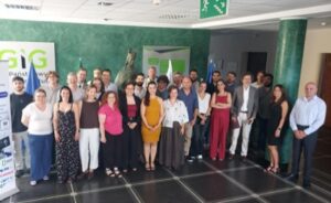
* The final results *
The development and implementation of interoperable cross-border Cooperative Intelligent Transport Systems C-ITS for road users is an essential innovation, since it enables more efficient traffic management and a safer and more sustainable mobility. The C-Roads Greece project, launched in June 2019 under the coordination of the Ministry of Infrastructure and Transport and with a Consortium of 10 partners, delivers a set of modern technologies and systems that were tested in sections of two pilot sites along Egnatia Odos Tollway and Αttika Tollway.
Fully aligned with the EU strategy for C-ITS and the corresponding national pilot tests in 18 Member States through the central C-Roads Platform, C-Roads Greece has thoroughly studied the wide and harmonious implementation of these services in Greece, yielding important results.
Smart Phone application for drivers that gives alternative routing when the congestion is high on the prime routes
As a start, dedicated mobile applications have been developed within C-ROADS Greece with the aim of providing trusted C-ITS services and disseminating safety and traffic related information that will be generated by the central C-ITS layer to drivers. With our partners at TELENAVIS at the forefront of this, we have been able to create a Smart Phone application for drivers that provides alternative routing and early notifications to the drivers when congestion is high on the prime routes. The offered solution also includes the following:
- Research of alternative road traffic status data
- Development of a special cartographic layer that maps the traffic situation in specific parts of the network where project equipment was installed
- Development of a prototype application for updating alternative routes
- Application controls and configurations
Attikes Diadromes participated in the C-Roads Greece project as the host of the field tests. Part of the road network of Attiki Odos was used to successfully test the developed app.
Shockwave Damping System with Watch and Warning detection
The Shockwave Damping service, developed by the UPatras, was implemented at Attiki Odos Tollway, aiming at detecting and estimating shockwaves on highways, with a view to mitigation, e.g., damping, and avoidance. The Shockwave Damping system performs two tasks. In the first, a potential shockwave is detected in space and time; a condition in which a potential shockwave has been detected is called a Watch Condition, and the algorithm aiming to detect such conditions is called Shockwave Watch Algorithm. In the context of the second task, an occurring shockwave is detected in space and time; a condition in which an occurring shockwave has been detected is called a Warning Condition, and the algorithm that aims to detect such conditions is called Shockwave Warning Algorithm. Both the Shockwave Watch Algorithm and the Shockwave Warning Algorithm are implemented by the system. To detect both situations, two separate Artificial Neural Networks were developed.
Shockwave damping serves to reduce the spread of traffic disruptions, which are brought on by abrupt changes in traffic flow, e.g. by sudden braking, lane changing or speed changes. Shockwave effects can be mitigated to stabilize traffic flow, allowing for smoother and more-efficient vehicle movement. Travel times are shortened, and congestion is reduced, thus resulting in safer roads. The likelihood of rear-end collisions and other accidents that are caused by rapid braking or unpredictable driving behavior can be reduced. This benefit is especially crucial for drivers in situations of heavy traffic. Shockwave damping service can also result in improved traffic flow and fewer stop-and-go situations, which can result in fuel savings for individual vehicles, and higher quality of travel experienced by individual drivers.
Cooperative Driving support is the next step. Intelligent vehicles with shockwave damping information would be able to actively take part in cooperative driving. To share knowledge about shockwaves and coordinate traffic operations to reduce negative impact, they can interact with other vehicles and the surrounding infrastructure. This cooperative behavior offers valuable support to improving overall road safety and traffic flow. In addition, Shockwave Damping Service can be utilized by intelligent electric vehicles to optimize their energy use. Supported by the service, the vehicles can alter their speed and acceleration patterns in a way that is more energy-efficient by predicting and reacting to shockwaves. This lowers pollutants and fuel consumption, reducing environmental impact and lowering the cost of operating the car. Intelligent vehicles could make more educated and proactive judgments thanks to shockwave damping information.
GeoMessaging Platform & TMC Emulator
The GeoMessaging Platform, developed by CERTH/HIT routes the C-ITS messages, considering the location information of possible receivers of those messages. The receivers are mobile and in-vehicle mounted systems utilizing cellular communications or Road Side Units that have a cellular or fixed line internet communications interface (e.g. cellular 3G/4G/LTE) to receive messages and then transmit those locally to nearby Onboard Units (OBUs) using the short-range G5 protocol. The operation of the Platform relies on the exchange of geo-referenced data. Through this functionality an overview of the location of the users of the C-ITS services is acquired, which is the necessary element for the Platform to define which entities will receive which messages. The Geomessaging Platform supports the following standard C-ITS messages: Cooperative Awareness Message (CAM), Decentralized Environmental Notification Message (DENM), In-Vehicle Information Message (IVI), Map Message (MAP), Map Extended Message (MAPEM), Signal Phase and Timing Message (SPAT), and Signal Phase and Timing Extended Message (SPATEM).
The TMC Emulator is an integrated dynamic traffic management and control system, that exploits the capabilities offered by C-ITS services, to improve road traffic of conventional, connected and automated vehicles. The TMC Emulator is comprised of two main components, the Scenario Manager and the Dashboard. The two components enable the coordinated activation and deactivation of C-ITS services in day-to-day dynamic traffic management and control and the real-time monitoring and visualization of Key Performance Indicators (KPIs) respectively.
The functionality of the Greek pilot C-ITS services relied on the operation of the GeoMessaging Platform, as this system was responsible for broadcasting the C-ITS messages to the users of the services. The C-ITS messages were broadcasted via the GeoMessaging Platform and then the drivers were able to see the messages in the HMI of their devices (smartphone, tablet, etc.). Logged data from the devices of the users of the C-ITS services were also collected in the back-office system of CERTH-HIT. The data were processed and analyzed for impact assessment and evaluation purposes. The TMC Emulator system was accessible to the road operators of the Greek pilot, i.e., Attica Tollway and Egnatia Odos Tollway. The staff at was able to create and send C-ITS messages in the network of the Greek pilot. CERTH-HIT conducted simulation experiments of the C-ITS services as well in the SUMO software environment.
Concerning the evolution of C-ITS services development and implementation, CERTH-HIT focuses on the integration of C-ITS services into traffic management processes and the traffic management of multimodal transport networks with mixed fleets (connected, cooperative, automated, and conventional vehicles). The main expectations relate to the establishment of optimized traffic flows and balance in road networks where dynamic interventions (traffic management strategies, control measures) could be implemented with the use of C-ITS services. The continuation of the work performed in the context of the C-Roads Greece project will be comprised of participating in other CCAM-related research projects where the already developed services and systems will be used and enhanced with advanced capabilities (i.e., AI elements). Moreover, CERTH-HIT focuses on the efficient exploitation of connected vehicles data, which could be fostered by NAPs and the development of open data repositories.
Development of I2V C-ITS services based on short (ITS-G5) and long (cellular) range communications on Egnatia Odos Tollway
Egnatia Odos contributed to C-ROADS Greece by developing I2V C-ITS services based on short (ITS-G5) and long (cellular) range communications along a pilot road section of Egnatia Odos Tollway. From the broad family of Day 1 C-ITS services that have been standardized in EU and become available for interoperable pan-European application through C-Roads Platform guidelines, message profiles and specifications, the following service categories were chosen initially to be implemented at Egnatia Odos pilot site:
- Roads Works Warning (RWW)
- Hazardous Location Notification (HLN)
- In Vehicle Signage (IVS)
- Probe Vehicle Data (PVD) – CAM Aggregation and from Day 1.5 C-ITS services:
- Smart Routing
The deployment of the above C-ITS services is expected to have positive impact on road safety issues and complement the existing traffic management procedures of the Traffic Control Center. Also, improvements are awaited to health and safety issues for maintenance personnel working on site through the usage of mobile RSUs that will assist the standard signing of work zones and allow to inform upcoming traffic on time.
All the C-ITS services deployed have been tested and evaluated internally during the project. Also, Egnatia Odos pilot site was selected to participate in the cross border tests with other EU Member States in autumn 2022.
Interoperability of C-ITS services were thoroughly tested and been proven. Visiting OBUs have received and decoded messages correctly. Minor findings were explained and have been solved.
Main lessons learned are that standardized C-ITS services can support seamless driving with safety and comfort across Europe. Few services need further elaboration and clarifications from C-Roads Platform WG2 in order to eliminate ambiguities in proper usage of message data elements. Also, complex road layout (i.e. successive tunnels) might cause service interruption due to GPS signal loss and it should be considered in future implementations by road operators.
Broader future integration of C-ITS services in the road network of Greece (motorways, national roads, urban areas, access to ports and airports) should be considered along with the possibility of enriching the already implemented C-ITS services at the two pilot sites.
Additional services from the family of Day 1 and Day 1.5 C-ITS services could be implemented on the highway network of Greece that will further enhance the benefits in terms of road safety improvements, environment protection and optimal use of the existing infrastructure. Such services that will provide advanced infrastructure-to-vehicle (I2V) and vehicle-to-infrastructure (V2I) communication capabilities might focus on improving the management of following topics: winter maintenance, road closures, automated vehicle guidance, emergency or prioritized vehicle approaching, emergency or rescue vehicle in intervention, toll station approaching, etc.
4G cellular communications with the installation of an additional base station in Egnatia Odos
COSMOTE provided full 4G coverage to both pilot sites to support the implementation of the designed solution, the integration activities and the verification of end-to-end proper operation for both Greek pilots. For achieving best possible results, COSMOTE installed one new base station in Egnatia Odos for the needs of the pilot in the particular area. ITS messages were successfully sent to vehicles using both the cellular 4G network, provided by COSMOTE, as well as the road operator owned RSUs (G5) a method known as hybrid communications. By utilizing hybrid communications, the end user can benefit by the advantages of both technologies (4G for extended coverage, G5 for low latency – delay).
The pilot results relevant to cellular 4G technologies and services include the successful reception of ITS messages by the vehicles using the cellular 4G network, provided by COSMOTE. These results prove that 4G cellular technology can be an alternative to ITS G5 for sending ITS messages to vehicles.
COSMOTE expects to contribute to the development of future road networks with its 5G (and beyond) technology and services. Constantly advancing the COSMOTE mobile network, COSMOTE was the first to bring 5G, the Internet of the future, to Greece. With its continuous expansion in more and more cities, COSMOTE 5G has the largest 5G coverage in the country, offering 97% coverage in Athens and 90% in Thessaloniki while in certain areas the maximum speeds already exceed 1Gbps. COSMOTE’s network is constantly expanding to offer its 5G services to main roads in rural Greece.
Development of a front-end Android HMI application
The developed front-end HMI application by ICCS is designed for Android smart devices, providing insights on traffic notifications for potentially hazardous events. Users of the application are drivers that commute within the two Greek pilot highways. They receive visual and vocal notifications while driving and a nearby traffic event affects their course. Through the application the users are informed on potentially hazardous events on the road, on harsh environmental conditions, they can receive personalized ad-hoc messages and they can navigate effectively through a smart routing service adapted for the scope of the project.
The front-end application is part of the overall C-Roads Greece architecture. It monitors all events captured by pilot users, which fundamentally affect their driving behavior. The notifications to the HMI user (driver) arrive early enough and not too soon or too late, thus they pose valuable guidance towards the conducted journey. On the one hand they receive in time informative notifications and drive more comfortably, and on the other hand they are in place to acknowledge more severe warnings which make their journey safer.
One evolution of the application is to be designed for iOS smart devices, addressing even more users. It can be also used to accommodate more C-ITS services, through the processing of additional message types, which consequently means more scenarios and use cases. It can be tested in other pilot highway sections of the two highways, in other road operators and ideally even within dense urban road networks nationally.
To accomplish all above, sufficient funding has to support the whole C-Roads Greece implementation schema, since the development of the front-end application should be accompanied by corresponding updates, development and support for the rest back-end systems.
PKI prototype system
A prototype software for the safe exchange of information between traffic participants was also developed within the framework of the project by G4S Telematix. It was applied on the various message types that were transmitted and received within the C-Roads pilot phase of C-Roads Greece. This system manages to sign the messages and mark them as secured, increasing the confidentiality, integrity and security of the piloted C-ITS services.
The two Greek pilots used in total two types of standardized messages, which were secured through the developed service. This was the case for both short-range (ITS-G5) and long-range (cellular) communication channels. For testing purposes, both signed and unsigned messages could be successfully exchanged.
Next steps in the development of the software prototype are to be updated not only to support more national road operators but also to become an official provider for securing C-ITS messages. Specific processes already set up by EU have to be followed before realizing this activity.
Object Detection & Tracking prototype approaches for automatic gathering information about road conditions
INTRACOM was responsible for the development of prototype approaches that use cameras and Image Processing & Artificial Intelligence (AI) technologies for Object Detection & Tracking Technologies with the aim to automatically detect critical issues on roads and inform instantly the C-ITS system and the C-ITS system the drivers possibly without human intervention.
The Object Detection is used to immediately locate critical objects or conditions on roads at an early stage before potentially hazardous situations arise. The use of these technologies can help in the immediate gathering of information about the situation on roads avoiding errors that may be due to the human factor. They are used in C-ITS Use Cases like slow or stationary vehicle(s), objects in traffic lanes or moving animals, vehicles moving in a dangerous or illegal manner. A prototype implementation of the new “Parking” C-ITS Use Case that uses these technologies has been evaluated. It performs automatic location tracking of parking spaces using cameras and AI models.
The services developed within the C-Roads project represent part of the future services to be used by the road users. The customized information provided to the road users regarding their specific location on the road network and the incidents taking place in front of them will be of key importance for both traffic flow optimization and more importantly increased level of road safety.